
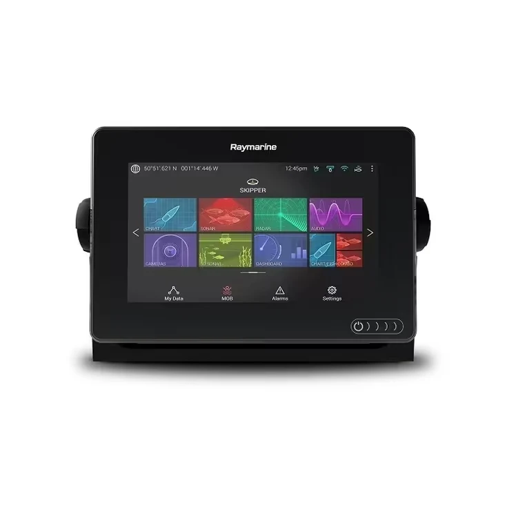
Fish finder vs chartplotter is not simply a choice between two screen sizes. A fish finder is built around sonar data from a transducer, while a chartplotter places the boat on an electronic nautical chart. Many modern multifunction displays combine both jobs, but the hardware and accessories required for each function still matter.
Fish finder vs chartplotter at a glance
| Feature | Fish finder | Chartplotter |
|---|---|---|
| Primary data | Sonar echoes from below or beside the boat | Position, routes and electronic nautical charts |
| Main accessory | Compatible transducer | GNSS/GPS receiver and suitable chart coverage |
| Best for | Fishing, depth and bottom interpretation | Navigation, planning and situational awareness |
| Can be combined? | Yes. Many multifunction displays support charts and one or more sonar types. | |
What a fish finder actually shows
A transducer sends acoustic energy into the water and receives the returning echoes. The display turns the return timing and strength into a view of depth, bottom hardness, structure and possible fish targets. Traditional sonar generally looks into a cone below the boat. Down-imaging and side-imaging systems use narrower, higher-frequency beams to show more structural detail.
The exact picture depends on frequency, beam shape, transducer power, installation, boat speed, water depth and display settings. A premium display cannot correct a badly positioned or incompatible transducer.
What a chartplotter does
A chartplotter combines satellite position with electronic chart data. Nautical charts show information such as depths, aids to navigation, coastline and charted hazards. NOAA calls nautical charts a fundamental navigation tool and notes that electronic navigational charts can support route monitoring and hazard awareness.
Chart coverage is regional. A model sold in one country may not include the charts required somewhere else. Buyers should confirm the exact map package and update method for the destination waters before ordering.
When a combination unit is the better choice
A combo display reduces helm clutter and can place chart and sonar views side by side. It is useful when a skipper wants to follow a route, monitor depth and mark fishing locations from one interface. Networked systems may also display radar, AIS, engine information and autopilot controls.
Integration introduces compatibility questions. Check the transducer connector and frequency, chart region, network type, radar model and software requirements. “Sonar capable” does not mean every transducer is supported.
Choose by boating style
- Small lake or kayak fishing: prioritize a readable fish finder with a suitable compact transducer; basic GPS waypoint capability may be enough.
- Coastal fishing: consider a chartplotter/fish-finder combo with CHIRP, detailed charts and room for AIS or radar integration.
- Offshore cruising: prioritize current charts, screen visibility, redundant positioning and integration with radar, AIS and heading data.
- Existing electronics: stay compatible with the transducers, network backbone and sensors already installed unless a full refit is planned.
Five checks before buying
- Measure the viewing distance, dash opening and clearance behind the helm.
- Confirm chart coverage for every country or region where the boat will operate.
- Choose the sonar functions and transducer before finalizing the display.
- List existing NMEA 2000, NMEA 0183 and Ethernet equipment.
- Plan a backup for position, depth and safe navigation if the primary display loses power.
Compare displays and sonar equipment by application and specification.
Frequently asked questions
Can a fish finder work without GPS?
Yes. Sonar can work without GPS, but you will lose chart position, route and waypoint functions unless the unit has its own positioning capability.
Can a chartplotter work without a transducer?
Yes. It can still provide chart and position functions. It will not produce live sonar depth and target data without a compatible transducer or networked depth source.
Is a phone navigation app a chartplotter replacement?
A phone can be a useful planning or backup tool, but power, waterproofing, heat, screen visibility, chart currency and positioning reliability must all be considered. It should not be the only navigation method for demanding passages.
Continue learning: see our marine GPS chartplotter guide and the upcoming guides to CHIRP sonar and transducer mounting.
Sources: NOAA Nautical Charts; Garmin scanning-sonar overview.